FUTURE - How it works


Refine solar resource estimates by calibrating satellite data with on-site measurements
12 MONTHS OF ON-SITE MEASUREMENTS
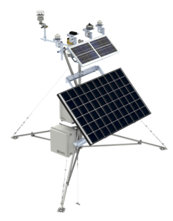
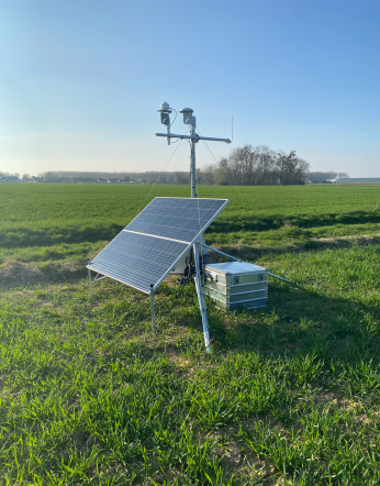
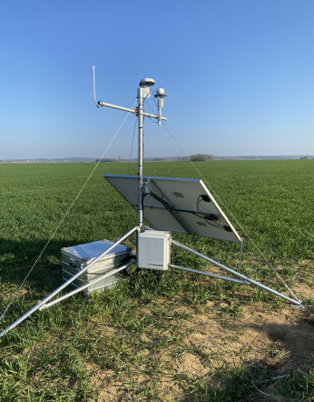
FUTURE is based on a 12-month on-site measurement campaign.
The duration of 12 consecutive months at a frequency of 5 minutes captures weather fluctuations specific to each season
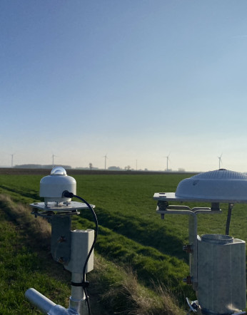
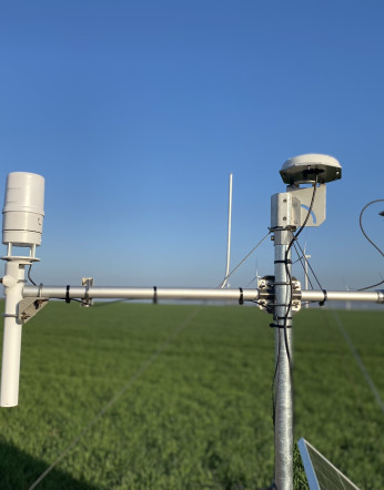
FUTURE can be adapted to meet specific requirements: optional sensors can be added for bifacial or agrivoltaic projects, for example. The weather station is 100% self-sufficient, with an oversized photovoltaic battery system, making it suitable for off-grid installation at prospecting sites.
SATTELITE DATA CALIBRATION
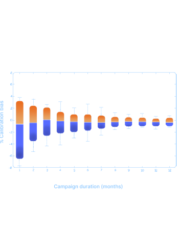
Calibration ensures reliable P50 yield and reduced P50/P90 gap.
Calibration is performed by correcting historical satellite data using the on-site measurement campaign.
FUTURE enables the calibration of satellite databases used to establish a meteorological year of typical irradiance (TMY – Typical Meteorological Year). Calibration is carried out by correcting historical satellite data, which has a systematic bias of +/- 5%. The systematic difference between on-site and satellite observations is qualified, and then our algorithm processes the entire data history to correct the bias.
CalibSun's methodology has been scientifically proven to reduce uncertainty in satellite databases from 3% to 0.5%. This results in a reliable P50 yield and a reduced P50/P90 gap.
ESTIMATING THE SOLAR RESOURCE
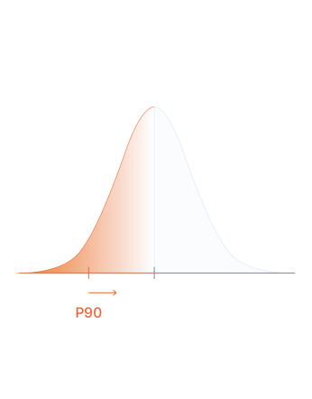
FUTURE provides key solar resource indicators: TMY, P90 and P50.
A TMY, P50 and P90 data package recognized by investors, banks and technical advisors.
With FUTURE, we deliver robust P50 and P90 values, including both GHI and production over the lifetime of your project.. The associated variability and uncertainty are detailed for each characteristic (irradiance, temperature, soilling, electrical losses, etc.).
It is the foundation of the project's economic model and a key element for investors, banks and stakeholders (experts, technical advisors, etc.). P90 is the reference value used by banks to size debt, so the higher the P90, the greater the borrowing capacity for the developer. P50, on the other hand, enables investors to assess project profitability.
Data quality
Calibsun guarantees top quality
Our customers have real-time data access. Additionally, we deliver detailed quarterly reports during the measurements campaign.
Availability check
CalibSun's FUTURE offer includes operational monitoring of the data collected on site.
Quality control
Our technical team conducts a thorough data quality check before the data calibration and post-treatment to ensure no errors.
Error-free GHI time-series
The measured irradiance time-series consists only of high-quality reliable data. Therefore, the post-treatment of satellite data yields high-quality, error-free results.

FAQ
Interested ? Ask for a one-to-one presentation.
Everything you need to know about estimating a site's potential.
Interested ? Ask for a one-to-one presentation.
Why does FUTURE make a real difference?
What are P50 and P90?
How is solar resource calibration done?


 en
en 
 fr
fr es
es de
de